
By Carmelo Garcia – Local Democracy Reporter
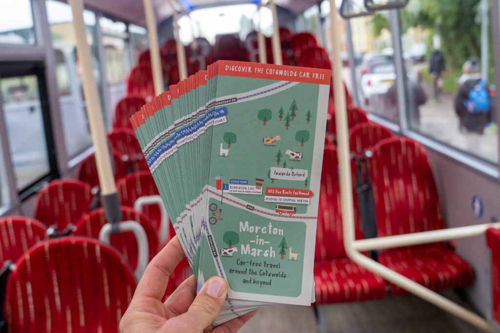
A new map has been launched, which could help fix the parking chaos caused by overtourism in the Cotswolds.
It shows people the best way to explore the area without the need of a car.
The unique map of the area shows Moreton-in-Marsh station as a focal point, and was developed by the Gloucestershire Community Rail Partnership (GCRP) in collaboration with Great Western Railway (GWR) and Pulhams Coaches.
The map promotes car-free travel and strong existing travel links across Gloucestershire and the surrounding counties of Oxfordshire and Warwickshire.
It is the eighth to be produced by GCRP who have a collection of trail maps which help make travel in the region both simple and sustainable.
With reports of Cotswold towns and villages experiencing high volumes of road traffic, there has never been a more appropriate time to utilise the breadth of public transport opportunities in the region, those behind the scheme say.
The new easy to digest map includes a detailed guide of the local travel network options including popular walks, cycling routes and bus connections – while celebrating the rich rail links in the area.
It looks to build travel confidence for visitors and locals with a handy visual aid which comes as a physical map or as a downloadable version.
The map is also supported with a video that captures car-free access to some of the Cotswolds’ most popular attractions, as well as the abundance of stunning countryside and all the best ways to explore it.
All of which are easily accessible without owning or having access to a car.
Moreton-In-Marsh is one of the most popular gateway stations to the Cotswolds and the 801 bus conveniently collects people from the platform.
The hop-on-hop-off bus connects the wider area removing any need for a car, stopping at other popular spots such as Stow-on-the-Wold, Bourton-on-the-Water, Chipping Norton, Andoversford, Charlton Kings and Cheltenham.
The Cotswold National Landscape is blessed with stunning countryside and picturesque villages, all conveniently connected by an impressive network of footpaths.
Helping you best navigate this unique environment, the map also highlights convenient bike and e-bike hire available, for those who are interested in travelling further and faster on two wheels.
One of the inspiring factors of this project was the fantastic links to the North Cotswolds, Oxfordshire, Gloucestershire and further afield.
Hannah McDonnell, Executive Director of the Gloucestershire Community Rail Partnership, has been the driving force of the project and commented: “We’re delighted to launch this initiative, which reflects our dedication to both responsible tourism as well as sustainable and accessible travel.
“The Cotswolds has so much to offer, and we want people to be able to experience it in an environmentally responsible way.”
The project was made possible thanks to the generous support and funding from Great Western Railway and Pulhams Coaches.
Commenting on their involvement in the project Eleanor Wills, Regional Development Manager (East) from GWR said: “GWR is proud to support this initiative, which aligns perfectly with our vision for a greener and more accessible rail network.
“The train is a fantastic way to see the Cotswolds, and this new map and video will inspire even more people to feel confident to experience car-free adventures.”
Echoing this response, Alex Chutter, Area Director of Pulhams Coaches added, “We’re excited to be part of this project, showcasing the fantastic connections between our bus services across the Cotswolds along with the other transport options available in the area.
“We’re committed to providing comfortable and convenient travel for all, and this initiative encourages people to leave their cars behind.”
The free map is available at Moreton-in-Marsh station, on the 801 Pulhams bus service, and can be downloaded from the Gloucestershire Community Rail Partnership website .
Gloucester News Centre – http://gloucesternewscentre.co.uk
